Nature Routes South of Nessebar: Ropotamo, the Dunes and the Protected Areas
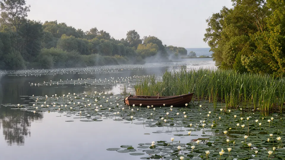
Drive south of Burgas and at some point the concrete simply stops. Past Chernomorets the coast turns into pine forest, rivers that empty straight into the sea, and sand dunes unlike anything else in Bulgaria. From there to the Turkish border stretches Strandzha, the country's largest protected territory.
This is a guide to the day, or two, when you leave the beach for the other face of the coast.
What is actually out there
- Ropotamo Reserve — a riverine "longoz" forest with white water lilies, wild climbing vine and over 250 bird species.
- The sand dunes at Arkutino, Alepu, Kavatsite and Smokinya — the best preserved in Bulgaria, with plants found nowhere else.
- Strandzha Nature Park — more than 1,100 sq km of forest, relict vegetation and villages where time stopped.
- The Veleka river mouth at Sinemorets, the most photographed bend on the Bulgarian coast.
For context on the plants see the botanical treasures of the coast, and on the dunes specifically guardians of the coast.
Distances from Nessebar
| Destination | Distance | By car |
|---|---|---|
| Kavatsite / Smokinya beach | about 68 km | about 1 h 10 min |
| Alepu | about 72 km | about 1 h 15 min |
| Arkutino | about 82 km | about 1 h 20 min |
| Ropotamo bridge | about 85 km | about 1 h 25 min |
| Beglik Tash | about 88 km | about 1 h 30 min |
| Sinemorets / Veleka mouth | about 145 km | about 2 h 15 min |
| Brashlyan village | about 150 km | about 2 h 20 min |
All of these realistically need a car. You can reach Primorsko and Ropotamo by bus, but the day becomes hard work. See the car rental and routes guide.
Route 1: Ropotamo in half a day
The easiest and most rewarding option, especially with a family.
Stop at the Ropotamo bridge on the Burgas–Primorsko road. Boat trips depart from there: typically a shorter run of around half an hour upstream and a longer one of about an hour down to the river mouth. Tickets are roughly €8–10 for adults and about half that for children; check on site, as prices and timetables shift with the season.
The river runs through a longoz forest — a flooded woodland of tangled trees and lianas, rare in Europe. Along the banks you will see white water lilies, herons, cormorants and, with luck, a white-tailed eagle. Boatmen point out the rock formations, the best known being the "Lion's Head".
Afterwards: Arkutino beach, five minutes away, for a swim among the dunes, or Beglik Tash, a Thracian rock sanctuary on a headland above the sea, with a short shaded trail and a nominal entry fee. Allow 4–5 hours plus driving.
Route 2: The dunes
Between Sozopol and Primorsko lie the country's most impressive sand systems: Kavatsite and Smokinya, wide beaches backed by dunes and pine; Alepu, a lagoon separated from the sea by a narrow sand bar and excellent for birds at dusk; and Arkutino, a protected marsh-and-dune complex with endemic plants that cannot survive trampling.
The rule for dunes is simple: do not walk on them. Dune plants hold the sand in place and recovery takes decades. Use the boardwalks and marked paths; fines for damaging dunes are real.
Route 3: Into Strandzha
With a full day and a taste for driving, head inland.
- Brashlyan, an architectural reserve of stone houses with wooden verandas and a small ethnographic complex.
- Malko Tarnovo, the park's centre, with a history museum and trail information.
- Silkosia Reserve, Bulgaria's oldest reserve, declared in 1931, home to the evergreen Strandzha periwinkle beneath oriental beech — a relict of the Tertiary period.
- Balgari village, where on the night of 3–4 June the nestinarstvo fire dance is performed — an authentic rite on the UNESCO intangible heritage list, not a staged show.
More in the Strandzha nature park guide.
Route 4: Sinemorets and the Veleka mouth
The longest but most beautiful day. The Veleka makes a wide bend and meets the sea between two beaches, and the view from the path above it is iconic. Nearby Silistar is a protected cove and one of the cleanest spots on the coast. Leave by 08:00.
When to go
- May–June: greenery at its peak, full rivers — and mosquitoes.
- September–October: the best window. Cool, dry, empty, with migration in full swing.
- July–August: hot; start early and carry plenty of water.
- Winter: Strandzha is lovely and empty, but many sites are closed.
Rules that matter
- In a reserve, stay on marked paths. Ropotamo has a strict protection regime.
- Pick nothing — no flowers, mushrooms or shells.
- No drones over protected areas without permission.
- Ticks. Strandzha has them from April to October: long trousers and an evening check.
- Fire. Summer fire risk is high; no open flames outside designated spots.
What to bring
Sturdy shoes, long trousers, water (reserves have no taps), binoculars, repellent, a hat, and more fuel than you think you need — petrol stations in Strandzha are scarce.
See also sustainable tourism in Nessebar, hiking near the Black Sea, the interactive map, the Nessebar guide and available apartments.
Frequently asked questions
Can I reach Ropotamo without a car?
Partly. The Burgas–Primorsko bus passes near the bridge, but the return depends entirely on the timetable. A car or an organised excursion is far easier.
Is it suitable for small children?
The Ropotamo boat, very much so. Long Strandzha walks are better from about age eight. And no, you may not take home sand or shells — the dunes are protected and removing sand is an offence.
Get local stories & deals
One email a month with the best Black Sea stories and seasonal deals. No spam.